Density Coordinated Ramp Control Field Implementation
Density Coordinated Ramp Control Field Implementation
Purpose:
This project evaluated the UMD KAdaptive ramp metering algorithm on Twin Cities freeways, ultimately replacing the existing Stratified Zone algorithm system-wide, while plans to test the UMN Density algorithm were deferred due to technical and scheduling issues.
Links:
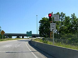
Full Paper DownloadResearch Paper Raw Data S3 bucketDownload Data via Globus Total Raw Data Size: 772 GiBCamera Information:
Camera Name: Hwy 100 and 36th St Bridge
Resolution: 640x480
Framerate: 15
Location: 44.937797, -93.349021
Camera Name: Hwy 100 and 50th St Bridge
Resolution: 640x480
Framerate: 15
Location: 44.912447, -93.350551
Camera Name: Hwy 100 and Auto Club Way
Resolution: 640x480
Framerate: 15
Location: 44.933077, -93.349460
Camera Name: Hwy 100 and Cedar Lake Trail Bridge (Greenway)
Resolution: 720x480
Framerate: 7
Location: 44.941283, -93.347924
Camera Name: Hwy 100 and Minnetonka Blvd
Resolution: 640x480
Framerate: 15
Location: 44.949531, -93.347558
Camera Name: Hwy 100 and W 41st St Pedestrian Bridge
Resolution: 640x480
Framerate: 15
Location: 44.926644, -93.349301
Camera Name: Hwy 100, N of TH7
Resolution: 720x480
Framerate: 7
Location: 44.948185, -93.347877